Site Mapping
Drop pins, draw boundaries, and annotate properties so every crew member knows exactly what to service.
Draw, Measure, Assign
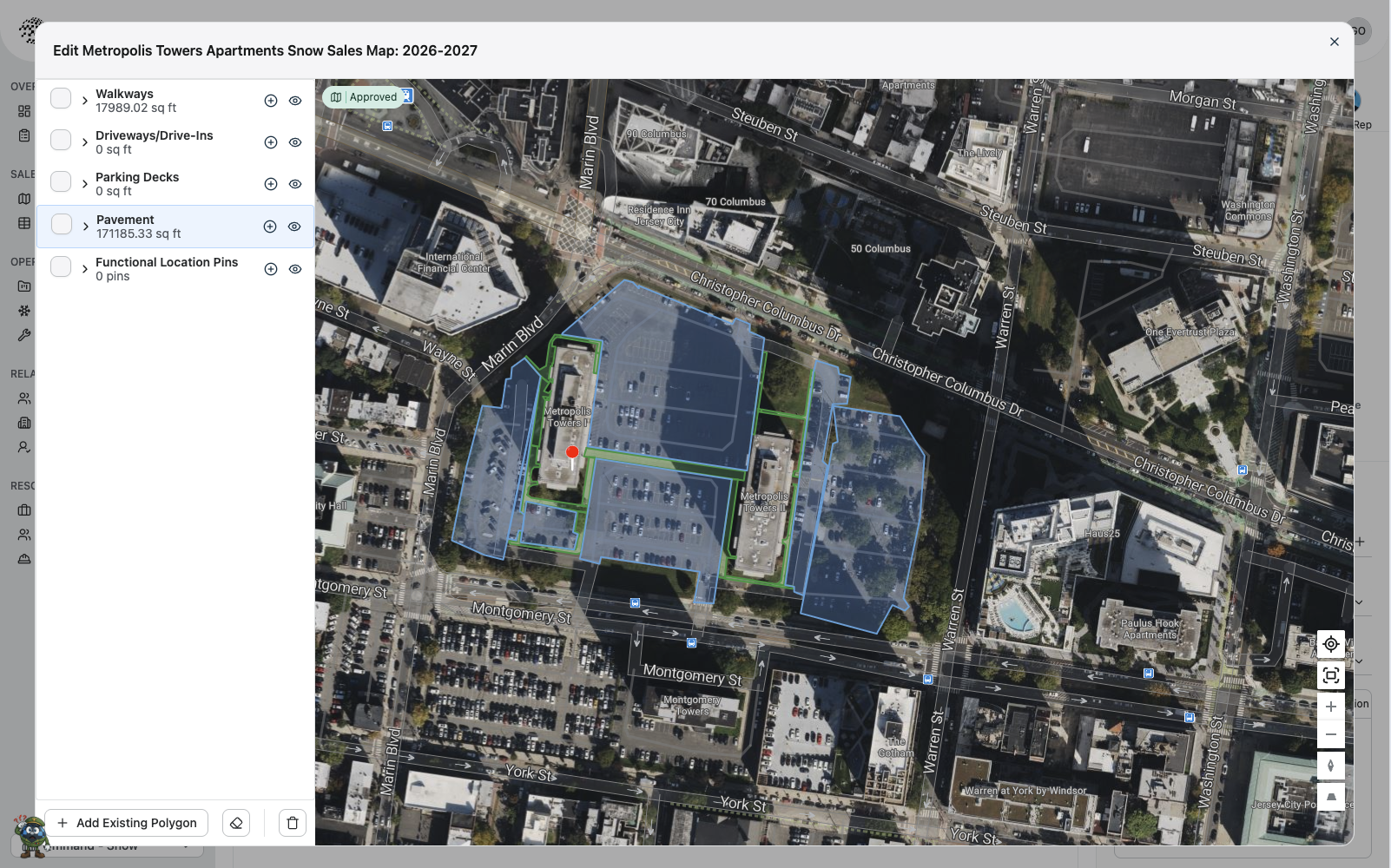
Interactive Property Maps
Draw polygons directly on satellite imagery to define service areas for every property. Separate walkways, driveways, parking decks, and pavement into distinct layers — each with accurate square-footage calculations used for quoting and crew planning.
Organized by Surface Type
Measurement Layers
Separate each property into walkways, driveways, parking decks, and pavement layers. Every polygon is measured automatically so you always have accurate square-footage data for quotes and service plans.
Pin What Matters
Functional Location Pins
Drop pins on salt bins, fire hydrants, dumpsters, or any landmark your crews need to know about. Pins stay attached to the property and show up on every crew member's map view.
Built-in Review Process
Approval Workflow
Submit site maps for manager review before they go live. Approved maps lock in pricing and service boundaries so crews always work from a verified, up-to-date plan.
Reuse What You've Built
Reusable Polygons
Add existing polygons from previous seasons or neighboring properties. No need to redraw boundaries year after year — just pull them in, adjust if needed, and you're set.
One Map, Two Workflows
From Sales to the Field
Site maps power your entire operation. During sales, accurate measurements drive profitable quotes. In the field, the same maps give crews a clear picture of exactly what to service — no guesswork, no missed areas.
Sales & Estimating
- Accurate area measurements for quoting
- Surface-type breakdowns for pricing tiers
- Manager approval before client presentation
- Season-over-season map history
Field Operations
- Crews see boundaries on their mobile devices
- Functional pins highlight key site features
- Clear service area definitions reduce errors
- Real-time map access — no printed PDFs
Ready to Map Every Property?
See how Qmmand gives your crews detailed site maps with boundaries, pins, and annotations — right on their phones.